PROJECTUAV-Monitoring Rauriser Sonnblick North Face
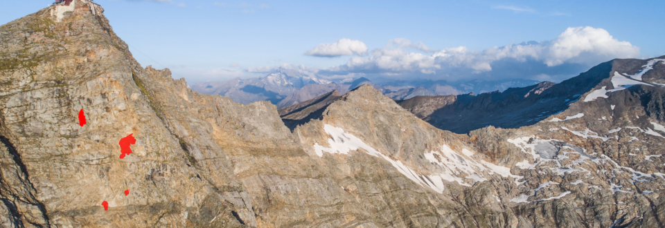
Few natural environments are more affected by climate change than high-alpine north faces. Permafrost melting and glacier retreat lead to significantly intensified process dynamics, making high-alpine north faces an extremely interesting research subject. Since 2019, GEORESEARCH, in collaboration with GeoSphere Austria, has been conducting drone-based long-term monitoring on the Rauriser Sonnblick. The project’s objective is to identify rockfall detachment areas within the approximately 900 meters (2200-3100 meters above sea level) high north face of the Hoher Sonnblick and subsequently answer the question of how the consequences of climate change (glacier and permafrost reduction) impact the occurrence of natural hazards (rockfalls).
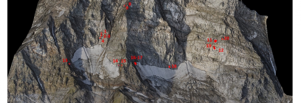
The mapping of the examined rock wall areas is carried out using UAV-based high-resolution photogrammetry. The flights are conducted once a year, at the end of the ablation period (late August, early September), as this period provides optimal conditions for capturing the rock surface due to maximum thawing. To precisely locate the UAV-images, a PPK-GPS extension and a total of ten ground control points are utilized. The flight route in the approximately 1.2km² study area is around 30km. To avoid shadows and ensure a seamless model of the entire surveyed slope, the images are captured in the nadir and at a right angle to the (average) terrain slope.
Compared to terrestrial laser scanning measurements carried out in the years before the start of UAV monitoring, the current UAV flights offer a consistent (short) object distance, thus maintaining a consistently high data quality. Previous laser scanning measurements conducted from the base of the wall resulted in surface models with significant shadowing, greatly reduced data quality in the upper wall area, and limited significance in the relevant area around the Sonnblick Observatory.
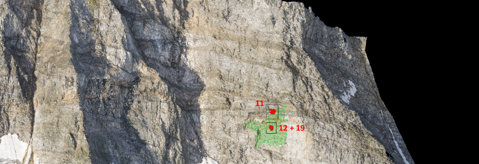
The results of the flights are high-resolution, comprehensive point clouds of the Sonnblick north face. Differential analyses of the annual images reveal remarkably high process activity. Besides numerous smaller events (> 100 m³), two large rockfalls stand out in the western wall area, with volumes of 15 600m³ and 23 500m³, respectively. The findings of the flights are published among other places, in the annually released Sonnblick brochure (see references).
The project directly builds upon the previous research project ‘SeisRockHT’ (Seismic Rockfall Monitoring Hohe Tauern, 2014-2017), within which precise event dates were assigned to identified rockfall detachment areas through passive seismic monitoring. This aimed to develop a better understanding of the causes and triggers of rockfalls in alpine north faces.


